
This principal aquifers map is available for download as a wall-map-sized PDF (14.4 MB), a printable PDF (1.7 MB), or available for purchase from the USGS Store.
An aquifer is a geologic formation, a group of formations, or a part of a formation that contains sufficient saturated permeable material to yield significant quantities of water to wells and springs. The areal and vertical location of major aquifers is fundamental to the determination of groundwater availability for the Nation.
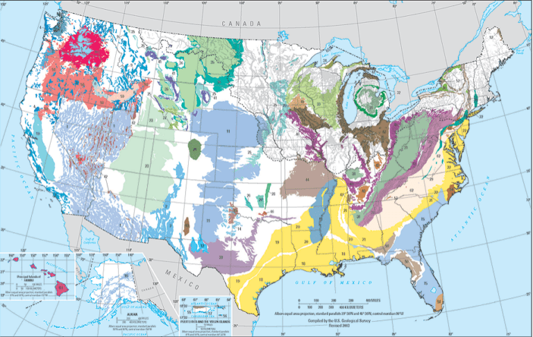
A principal aquifer is defined as a regionally extensive aquifer or aquifer system that has the potential to be used as a source of potable (drinkable) water. For study or mapping purposes, aquifers are often combined into aquifer systems.
A two-dimensional map representation of the principal aquifers of the Nation is shown [below –ed]. This map, which was derived from Ground Water Atlas of the United States data (published as part of the National Atlas in 1998, revised 2003) indicates the areal extent of the uppermost principal aquifers on a national scale.
National Aquifer Code Reference List
The principal aquifers shown on the 2003 map above, with some additions, were used as the first National Aquifer reference list in the USGS National […]
Full article: Principal Aquifers of the United States