Photo: still image from video — click link below to view the video.
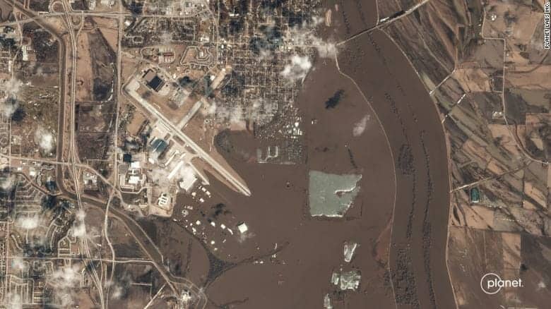
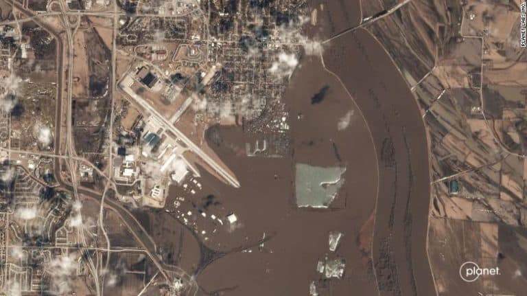
(CNN) Satellite images show just how high the water has risen along the Platte and Missouri Rivers, including a large portion of a US Air Force Base under water.
Upstream from Scribner, Nebraska, on the Elkhorn River, a flood gauge measured its second highest crest: 17.65 feet. The flood gauge just downstream from the town stopped reporting on Wednesday when minor flooding was taking place; it could have been affected by ice floes.
The images show how the Elkhorn River temporarily made the town of Scribner an island. It appears, looking at satellite imagery, the only connection for the almost 900 residents of the town was Highway 275.
Normally, the Logan Creek Dredge, the river that flows into the Elkhorn River, is barely visible. It, too, far exceeds its usual banks.
It beat the previous record, set in 1962, by more than 5 feet. The Platte River, to the left in the image, also was at historic levels farther upstream, in Leshara, Nebraska.
How much water was flowing in the Platte River is apparent by how far it exceeds its banks between North Bend and Fremont, Nebraska.
Platte River west of Fremont, Nebraska Platte River west of Fremont, […]
Full article: Satellite images show Nebraska and Iowa rivers swallowing towns