
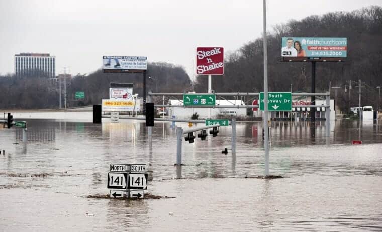
Intersection of Interstate 44 and Route 141 in St. Louis County, Mo., on Dec. 30, 2015. Water levels more than 4 feet higher than previous record floods closed a 20-mile stretch of the highway. (Photo: © Sid Hastings)
At the end of December 2015, a huge storm named “Goliath” dumped 9–10 inches of rain in a belt across the central United States, centered just southwest of St. Louis, most of it in a three-day downpour. The rain blanketed the Meramec Basin, an area of 4,000 square miles drained by the Meramec River, which enters the Mississippi River south of St. Louis. Extraordinary rainfall between Dec. 22–29, 2015, covered the entire Meramec River drainage but only 5% of the Mississippi River’s much larger watershed above St. Louis.
The Meramec’s response was dramatic. Gauging stations recorded a pulse of water that grew as it traveled down the main stem of the Meramec River, setting all-time record highs in the lower basin in the Missouri cities of Eureka, Valley Park, and Arnold. While extraordinary rain drenched the entire Meramec Basin, only 5 percent of the Mississippi River’s giant watershed above St. Louis was so affected. Yet […]
Full article: Record Missouri flooding was manmade calamity, scientist says