
Here’s how that water gets divvied up.
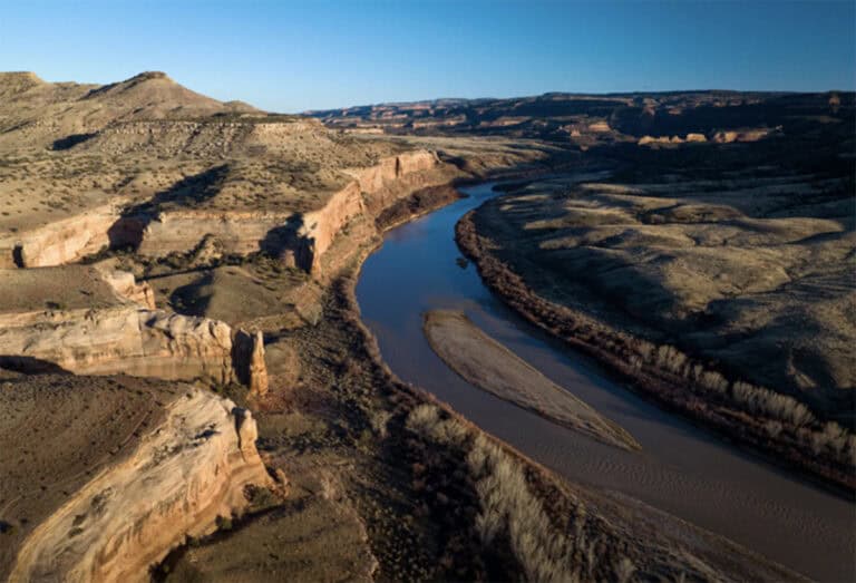
The Colorado River passes through Mesa County, March 7, 2024, near Loma. The river flows for at least 1,450 miles from the Rocky Mountains in Colorado to the Gulf of California in northwest Mexico. (Hugh Carey, The Colorado Sun)
The Colorado River provides water for millions of people, including Coloradans from the Western Slope to the Eastern Plains. But much of the river system is overallocated, its waters are overused and its flows are shrinking.
“It’s not a rosy picture. We’ve been in a drought for a very long time,” said Kevin Reidy, senior state water efficiency specialist with the Colorado Water Conservation Board, the state’s top water agency. “Really, what we’re looking at is aridification across the state, across the Southwest.”
How long is the Colorado River?
The Colorado River starts as snowmelt north of Grand Lake in Rocky Mountain National Park and flows more than 1,400 miles — longer than the drive from San Diego to Seattle.
In Colorado, the river parallels Interstate 70 from Dotsero to Grand Junction before leaving the state. Then it passes through Utah, Lake Powell, the Grand Canyon and Lake Mead near Las Vegas. One section, through the Grand Canyon, is considered the most endangered waterway in the U.S.
After Lake Mead, it heads down the California-Arizona border into northwestern Mexico. The river’s natural course ends in the Gulf of California, but since the early 1960s, when Glen Canyon Dam impounded the river near Page, Arizona, it has rarely reached the Pacific Ocean.
What is the Colorado River Basin?
Like other river drainage basins, also called watersheds, the Colorado River Basin is an area of land that collects the precipitation within it and drains it into a common outlet, the Gulf of California.
The enormous basin covers about 246,000 square miles and seven U.S. states: Arizona, California, Colorado, Nevada, New Mexico, Wyoming and Utah. It includes two Mexican states, Baja California and Sonora, and the lands of 30 federally recognized tribes.
The Colorado River’s tributaries include some of Colorado’s most well-known local rivers, like the Yampa, White, Eagle, Roaring Fork, Gunnison, Animas and Dolores. Some of the river’s major tributaries that pass through other states include the Green, San Juan, Little Colorado, Gila and Virgin.
On average, about 170 million acre-feet of precipitation falls over the Colorado River Basin annually, but only about 10% of it reaches streams and is available for use. One acre-foot supports about two families of four to five people for one year.
The basin is also mind-bogglingly old: It began forming about 40 million to 70 million years ago when two tectonic plates collided, forming the Rocky Mountains. That means it could be as old as the Tyrannosaurus rex. Most researchers agree the Colorado River established its present course about 6 million years ago, which is around the time that humans’ first known common ancestor may have appeared.
Why is the Colorado River system important?
Without the Colorado River, life in the American Southwest would not be what it is today — it’s that important. The river system supplies about 40 million people with water, helps provide food for the nation and supports impressive biodiversity.
The Colorado River system has supported ecosystems and Indigenous communities since time immemorial. In the 1800s, settlers arrived in the basin’s arid landscapes where irrigation was the only way to grow a crop. They established the current way of using the river’s waters — water law, ditches, tunnels and dams.
Now, the river’s economic value is estimated to be $1.4 trillion per year. It irrigates about […]
Full article: www.montrosepress.com